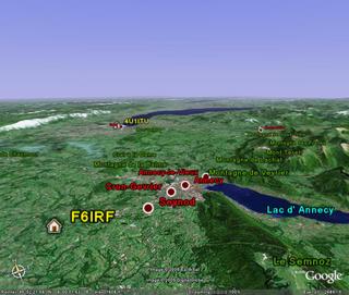
Google-earth 3D-view of my QTH.
Marcellaz-Albanais is located about 40kms south from Geneva and the Swiss border. Toward east are the Alps, and toward west, the Jura. Altitude of my QTH is 563m, overhanging the "Fier valley". On the right bottom corner of the above picture is the "Semnoz", culminating at 1700m.
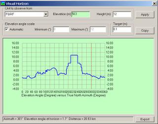
Terrain profile to JA (Az=36), my best direction. The lower point is the "Fier river".
 Below is the minimum take-off angle function of the azimuth. The dotted line is for USA (not too bad); the
  worst directions are South America and Western Africa. (profiles done with radio-mobile, freeware by VE2DBE - Elevation data is from the Shuttle Radar Topography Mission - Nasa).
Though far form being ideal, I have a good take-off to contest most active areas. You can see both my bonus (the take-off to North sector), and my main handicap (the 380kV power line) on my 1991 EME system pictures (F6IRF - The EME years).

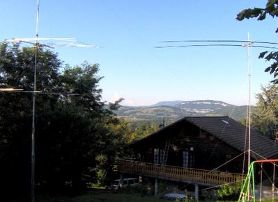
My north sector, with the "Saleve" in the far (the Saleve is the mountain which overhangs Geneva)
No comments:
Post a Comment